Update 11:08 a.m.
I-39/90 North at WIS 59 near Newville. The left shoulder is blocked due to a semi off to the side.
Update 8:47 a.m. **CLEARED**
I-39/90 South at Ramp from US 14 in Janesville. The center lane is blocked due to a disabled vehicle.
Update 8:22 a.m. **CLEARED**
I-39/90 South at the Milwaukee Street underpass. The right shoulder is blocked due to a crash.
****
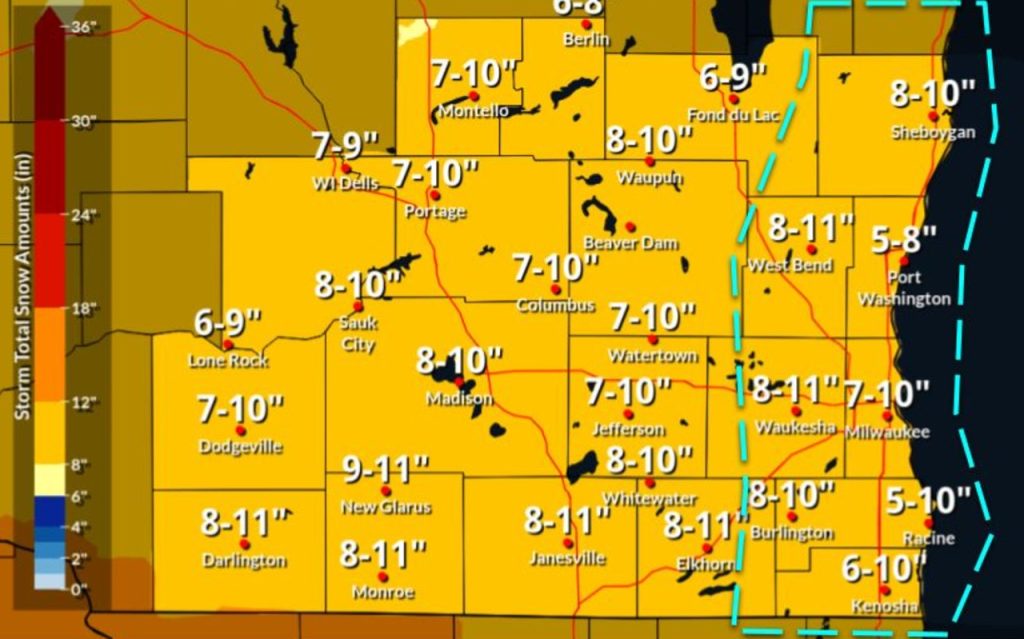
JANESVILLE — A major winter storm is moving through the Janesville area Saturday, with the heaviest snow and worst travel conditions expected during the next 11 hours.
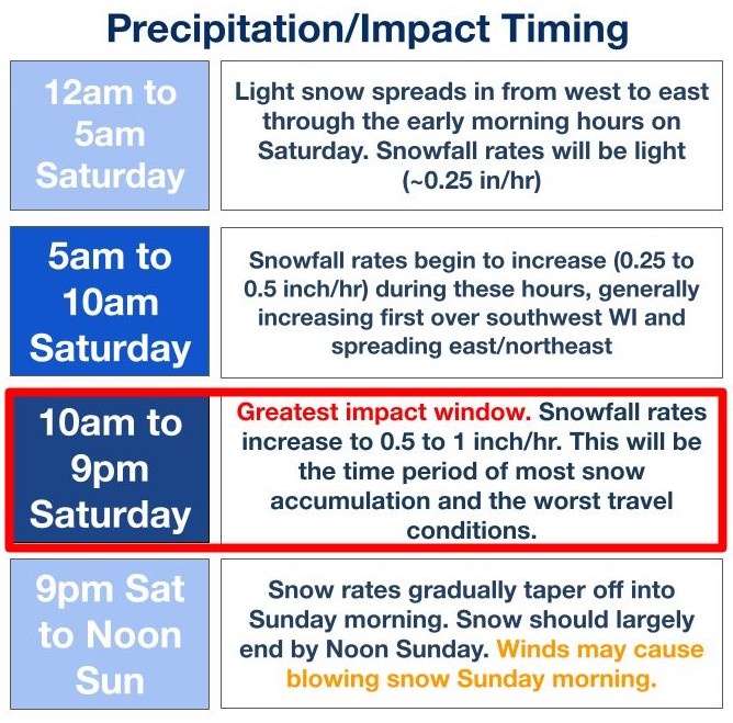
According to the latest precipitation and impact timing forecast from the National Weather Service in Sullivan, the storm will spread across the area from west to east, beginning in the early hours of Saturday morning.
Timing and Impact Breakdown
- 12 a.m. to 5 a.m. Saturday: Light snow will spread, with minimal snowfall rates around a quarter of an inch per hour.
- 5 a.m. to 10 a.m. Saturday: Snowfall rates are expected to increase to about a quarter to a half of an inch per hour. The increase will generally begin in the southwest parts of Wisconsin before spreading eastward and northeastward.
- 10 a.m. to 9 p.m. Saturday (Greatest Impact Window): This is the period of most significant concern. Snowfall rates will increase substantially, ranging from one half to one inch per hour. This time frame is anticipated to see the most snow accumulation and bring about the worst travel conditions of the event. Residents are urged to avoid non-essential travel during these hours.
- 9 p.m. Saturday to Noon Sunday: Snow rates will gradually decrease. The snow is expected to largely end by noon on Sunday. However, winds may cause blowing snow on Sunday morning, which could continue to affect visibility and travel.
Authorities advise residents to monitor local forecasts and prepare for hazardous conditions, particularly throughout Saturday.


